By Dr. Matthew D. McKnight, MHT Chief Archaeologist
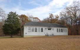
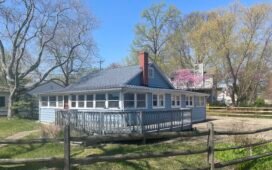
Situated amidst a landscape of rolling agricultural fields, equestrian riding trails, horse jump courses, and woodlots, the Maxwell Hall Equestrian Park will play host to the 2025 Tyler Bastian Field Session in Maryland Archaeology from May 23rd-June 2nd. Each year this important annual event brings citizen scientists from the Archeological Society of Maryland (ASM) together with MHT archaeologists and members of the general public to make lasting contributions to our understanding of Maryland’s shared history. The focus of this year’s work will be the late 17th to mid 18th-century colonial occupation at the Teague’s Point Site. It wouldn’t have been possible without the generosity of Mr. Kevin Brady.

Kevin Brady is an avocational archaeologist who collected the fields around Teague’s Point in the 1970s, before the land was acquired by the State of Maryland. Logging the locations of his finds to a hand-drawn map, Mr. Brady recovered hundreds of colonial objects and a few precontact Native American artifacts from the furrows left by the farmer’s plow. His collection includes numerous examples of 17th and 18th-century pottery, olive green bottle glass, over 200 pieces of kaolin tobacco pipe, gunflints, iron nails and other pieces of metal, animal bones, lead shot, and stone projectile points (see the slideshow below). In August of 2023 he reached out to MHT, and Dr. Zac Singer and I travelled to Maxwell Hall Equestrian Park to see Mr. Brady’s collection, his map, and to hike to the spot where he’d made these finds so many years before. On the field margins, we soon spotted fragments of olive green colonial bottle glass, and knew that we had a previously undocumented site to add to the Maryland Inventory of Historic Properties (MIHP). Thus, Teague’s Point was assigned the site number, 18CH1005 and a new archaeological site was “born”. Without Kevin Brady’s willingness to share his collection, his maps, and his knowledge about the site, this snapshot of Maryland history would have gone unrecorded, and for that we are in his debt.
Not long after initially learning about the site, we began coordinating with the local tenant farmer, Maryland DNR, Charles County Rec and Parks (which operates the park on the state’s land), the Charles County Archaeologist, and the Charles County Chapter of the ASM to conduct a ground penetrating radar (GPR) survey at Teague’s Point as soon as that year’s soybean crop could be harvested. In November of 2023 we got the call and by early December we were out in the field.

While the weather was quite mild and cooperative for December, the soils were not. Moisture on the fields froze the night before our fieldwork and as the sun appeared, conditions quickly devolved into a muddy quagmire. Nevertheless we soldiered on and managed to collect data from about 9/10ths of an acre, which easily encompassed the extent of the area mapped by Mr. Brady (again, thank goodness for collectors who take notes and are willing to share them). GPR works by sending a radar pulse from the instrument into the ground and measuring the time it takes for that pulse to return to the antenna after it bounces off of buried soil layers, tree roots, and subsurface anomalies. By collecting data in tightly-spaced transects, we are able to build a 3D model of what lies beneath the ground’s surface. What we located on this project was astounding! In the northeast portion of our survey grid, we located a cluster of rectangular anomalies beginning just below the plowzone and extending to around 130 cm (about 4.25 feet) below surface. These anomalies are suggestive of cellars and/or subfloor pits and likely indicate the presence of a former earthfast structure.
So, what did we have? Based on the combination of the GPR data and examination of Mr. Brady’s collection, site 18CH1005 appears to be the remains of an intact late 17th to 18th-century domestic structure…a house. But who lived here? That is the question we hope to find the answer to at the Field Session this May. Currently, the leading contender is a tenant farmer named Michael Smith.

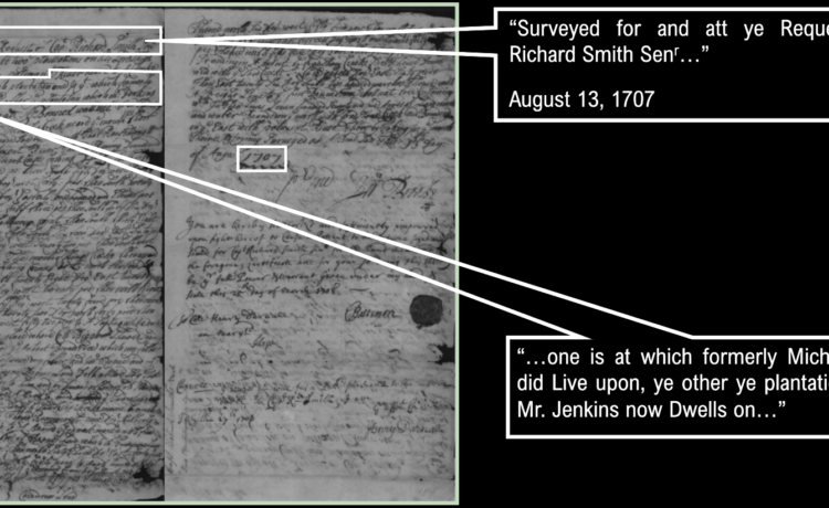
We initially thought the land might have been occupied by Captain Richard Smith, one of the few Protestant militia officers to support Lord Baltimore during the “Glorious Revolution” of 1688-1689. However, Capt. Smith appears to have been settled elsewhere within the colony, and though he was the first Englishman to patent the land, it seems that others were actually living at Teague’s Point. Charles County Archaeologist, Esther Doyle Read, was able to point us towards an unpatented certificate for a survey carried out in 1707 on behalf of Capt. Smith. Fortunately, that document provides important clues as to who was living on this landscape during that late 17th to mid 18th-century timeframe which all of the artifacts seem to date to.
The certificate mentions two plantations present on the landscape in 1707: that of a “Mr. Jenkins”, and the former plantation of Michael Swift. Mr. Jenkins is believed to be one Richard Jenkins, who, as illustrated by his will, lived with three orphans and a “beloved” friend named Rebecca Duphex. The inventory for Mr. Jenkins also shows one enslaved man of African descent living on the property. Richard Jenkins died in 1712. Work conducted by the Maryland State Highway Administration in 2013 at the nearby Serenity Farm identified a site (18CH953) where the ceramic end date appears to be around 1710, suggesting that Jenkins lived to the south of Teagues Point in 1707 when his presence was recorded in the certificate. Michael Swift is described as living at a different plantation on the same tract. Swift died in April of 1694, leaving a wife, Margaret, and two daughters named Elizabeth and Mary. It is unknown at this time if Margaret and her daughters continued to reside on the land after Michael’s death. If so, they are not mentioned in the 1707 survey.
The Smith family would eventually be issued title to the land in 1729. Captain Smith died in 1714 and so it was his son, Charles Somerset Smith, who would eventually be issued the certificate for the land surveyed by his father. The Smiths would hold the lands surrounding Teague’s Point for generations. When Charles Somerset Smith died in 1738, he left the lands south of St. Nicholas Creek (including Serenity Farm) to his son Richard. The lands to the north went to Richard’s twin brother, Charles. Their father’s will notes that Charles Jr.’s inheritence included the lands, “…where my dwelling plantation now stands”. The diagnostic artifacts from 18CH1005, to date, seem to comport well with the occupations of Michael Swift and Charles Somerset Smith who may have taken up residence on the cleared land where the Swift plantation had been. At least…that’s our story for now. More research in both the archives and in the field is needed.
Come help us flesh out the story! You can sign up to particpate in the 2025 Tyler Bastian Field Session in Maryland Archaeology HERE. No experience is necessary.
If you know about an archaeological site or have located an artifact you would like to report to the Maryland Historical Trust, check out the mdFIND app.
Discover more from Our History, Our Heritage
Subscribe to get the latest posts sent to your email.