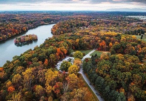
ANNAPOLIS, Md. – The Maryland Department of Natural Resources (DNR) and the Chesapeake Conservancy recently partnered to produce an updated mapping of Maryland’s Habitat Connectivity Network.
The data improves the state’s understanding of where the most important natural habitat areas in the state are currently located, how these areas are connected, and how these areas have changed through the past two decades.
Maryland DNR defines the habitat connectivity network as a system of “hubs,” large intact areas of natural forest, wetland, and aquatic habitat, and “corridors,” the pathways that connect hubs. These hub and corridor areas are vital to maintaining healthy wildlife populations across the state because many species require natural habitat areas above a certain size to thrive as well as natural corridors between habitat areas to find food and mating opportunities. Additionally, these natural areas provide a number of ecosystem service benefits to the citizens of Maryland, including clean water, clean air, carbon sequestration, and climate resilience.
Maryland’s Habitat Connectivity Network, referred to as Green Infrastructure in its prior iteration, was first produced in 2005, with updates to hub areas in 2011. This new update leverages the Chesapeake Bay Program’s cutting-edge, high-resolution 2017/2018 land use/land cover mapping produced by Chesapeake Conservancy and partners. The Habitat Connectivity Network data project also provides several additional enhancements, including differentiation of hub and corridor types–forest, wetland, or aquatic, a breakdown of land cover types within corridors, and identification of potentially restorable gaps within corridors.
These data sets provide essential information for environmental planning to support Maryland DNR and its partners in local government and nonprofits. The information can also help target and prioritize lands for protection or restoration.
“Maryland’s Habitat Connectivity Network mapping is an important element of DNR’s work to preserve ecologically sensitive areas and inform the Rural Legacy Grant review system,” said Maryland Department of Natural Resources Secretary Josh Kurtz. “These upgrades to our data system will improve our efforts to identify and protect land resources in every part of Maryland.”
This dataset will help guide Bay restoration by providing more data to better direct efforts to improve shallow water habitat and increase coastal resilience.
“Chesapeake Conservancy is proud to partner with the state of Maryland on this critically needed update to habitat connectivity data,” said Chesapeake Conservancy President and CEO Joel Dunn. “As the state continues to grow and develop, Maryland has responded to the global nature crisis by setting the goal to conserve 40% of the state’s lands by 2040. These data will help planners focus their conservation efforts on the places that matter most for nature to have the space to thrive.”
The updated Habitat Connectivity Network map layer can be viewed on the Maryland GreenPrint web map. The data layer can be downloaded from the Maryland iMap Data Catalog. An archived version of the original Green Infrastructure data can be accessed online.


